The 2021-2022 Winter Forecast
- Owen Anastas

- Nov 8, 2021
- 2 min read
With the changing of the clocks comes the changing of the seasons and along with that is almost always questions about what the winter ahead will bring. Will it snow? Yep. Will it be cold at some point? Yep. Those are about the only two things that are guaranteed with every winter, with the finer details lying in exactly how much snow we get and exactly how cold it gets. With gas prices at all time highs and many households and businesses still recovering from the pandemic, this winter has the potentially to be economically detrimental to some people if it is overly cold.
With that in mind, let's dive in to what we used to craft our winter forecast this year, with the first and arguably most important being the ENSO. This year we are looking at a moderate La Nina, meaning that temperatures in the equatorial pacific are running below normal.
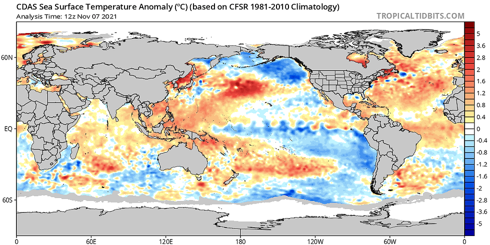
Image Credit: Tropical Tidbits
La Nina winters tend to be both front-loaded and wide ranging in total snowfall. Typically, Northern New England does very well during La Nina winters, with Southern New England doing about average and the Mid-Atlantic getting below average snowfall and much above average temperatures.

Funny enough, that is exactly what our forecast calls for: a very snowy ski country, with SNE doing decent and the Mid Atlantic getting the short end of the stick. However, with snowfall forecasts it is important to note that they often hinge on the placement of one or two storms- if they hit, the forecast verifies, if they miss, so often does the forecast miss too.
We are forecasting a storm track this year that moves mainly west to east, these storms more commonly being referred to as "sliders", as they slide from west to east along a thermal gradient.
Speaking of thermals, we are forecasting a winter with above average temperatures, as there have been for many winters in a row now.

While we think the SE ridge will stay away during the early winter, it is quite possible that it comes back strong in Mid-January onward, especially with the presence of a -PDO.
For Southern New England specifically, as we have done the past two years, we put together what we think will be the seasonal snow totals around the region in the map below:

By our forecast, we believe that interior SNE will do quite well this year, with coastal locations potentially struggling with very above average SSTs (sea surface temperatures). Since we are forecasting a front- loaded winter, we believe that warm SSTs will be a problem this year more so than others because ocean temperatures are often warmest in the early winter.
Overall, this winter looks to be quite similar to last years, which was also a La Nina winter, with the potential for some big storms and also some decent events interspersed throughout. For now, we will take it week by week as we begin our descent into the dark, cold days of winter. Enjoy the rest of your week and please, if you have any questions, do not hesitate to reach out.


Comments